SPONSOR:
Pacific RISA / Water Resources Research Center
PROJECT PERIOD:
2015 – no end date
PROJECT PIs:
Chris Shuler and Aly El-Kadi
ABSTRACT:
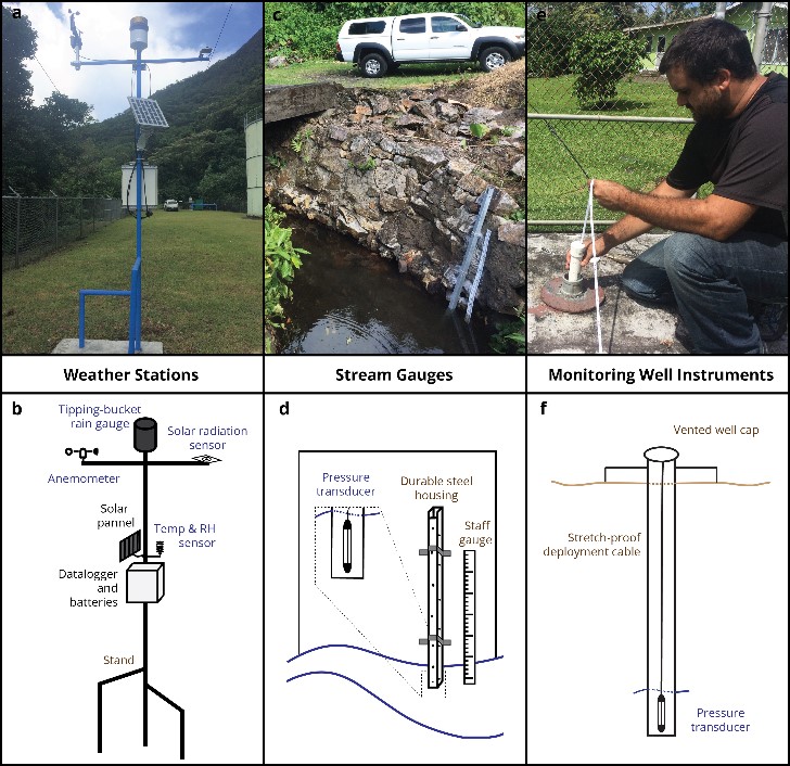
Quantifying hydrologic parameters such as precipitation, streamflow, evapotranspiration, and aquifer response are fundamental to understanding a region’s hydrological budget, and thus the availability of water resources. These hydrologic datasets are essential for the design of sustainable water supply systems and for the prediction or detection of acute threats to drinking water quality or availability. The ASPA-WRRC monitoring network consists of 21 instruments including weather stations, stream gauges, and monitoring well dataloggers. The weather station network consists of seven discrete stations. The stations all have the capability to record precipitation, temperature, relative humidity, wind speed and direction, and solar radiation. The weather (Wx) network covers most of the lateral extent of Tutuila Island, from Poloa (at the western tip) to Fagaitua (in the Eastern District). The ASPA-WRRC stream gauge network currently consists of eight gauges located on different streams throughout Tutuila. The stream gauges are instrumented with a stainless steel or titanium HOBO water level logging pressure transducer installed in a durable steel housing. Water level loggers were deployed in 5 wells. Streamflow, monitoring well, and weather station data are then downloaded by a technician at ASPA, and the data is uploaded to the cloud-based data repository on GitHub.
Project Publication:
Shuler, C., and A. El-Kadi. 2018. WRRC-ASPA Hydrologic Monitoring Network Handbook. WRRC Special Report SR-2018-02, Water Resources Research Center, University of Hawai‘i at Mānoa, Honolulu, Hawai‘i.
Url to project page:
https://integratedmodelingframework.weebly.com/
PRINCIPAL INVESTIGATOR

