SPONSOR:
USGS, Pacific Islands Climate Adaptation Science Center
PROJECT PERIOD:
09/01/15 – 08/31/20
ABSTRACT:
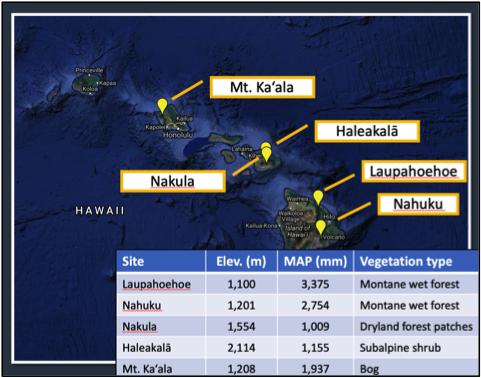
Persistent orographic lifting produces frequent fog on high tropical mountains, and forms hydrologically, biogeochemically, and ecologically important zones called Tropical Montane Cloud Forests (TMCF). Cloud water interception (CWI) adds a significant amount of water to that provided by rainfall within TMCFs. Previous observations of CWI at four sites in Hawai‘i indicate that CWI has great hydrological and perhaps ecological significance in Hawai‘i. The objective of this study was to provide data needed for developing a model to simulate the spatial patterns of CWI in Hawai‘i. To obtain the data, we deployed sensors and canopy water balance systems to estimate CWI at five sites. Soil tensiometers were deployed at three of those sites to estimate the spatial and temporal variability of recharge rates associated with CWI. Field sites were selected to sample a range of fog, rainfall, and vegetation conditions.
URL to project page:
https://sites.google.com/a/hawaii.edu/ecohydrology_lab/current-research/CWIinHawaii
PRINCIPAL INVESTIGATOR
